Moncton weather doesn’t fit easily into neat boxes. It’s a true Atlantic Canadian blend: snow-laden winters that can flip to rain and back again, warm and humid summers with sea breezes a short drive away, and shoulder seasons that keep you guessing. If you live in the city or plan to visit, understanding how Moncton’s climate behaves—month by month and hour by hour—pays off. You’ll know when to expect a nor’easter, why the humidex bites in July, how frost dates shape gardens, and what “rain changing to snow” really means on your commute. This practical guide compiles real-world insight, local context, and Canadian standards so you can read the sky with confidence and make better decisions around travel, work, and life.
Where Moncton Sits—and Why It Matters for Weather
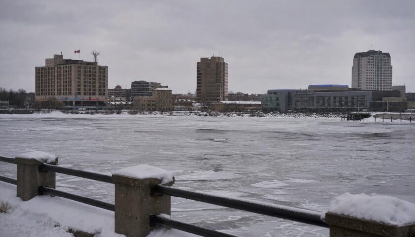
Moncton is tucked in southeastern New Brunswick along the Petitcodiac River, roughly a half-hour from the Northumberland Strait and around an hour from the Bay of Fundy. That geography sets the stage. Air masses off the Gulf of St. Lawrence carry moisture and summer warmth; Fundy’s cold waters and dramatic tides help breed fog and fickle spring temperatures. The city itself lies inland enough to avoid the thickest coastal fogs, yet close enough to feel ocean influence on wind, humidity, and storm tracks. The result is a humid continental climate with a maritime twist.
Atlantic Canada’s weather engines are the real plot drivers here: nor’easters on the winter storm conveyor belt, clippers tracking in from central Canada, and the occasional ex-tropical system in late summer and fall. Moncton sits at the crossroads of those systems, which is why forecasters in New Brunswick are careful about precipitation types and temperature gradients—it doesn’t take much for rain to switch to snow or for a snow event to glaze over into ice pellets and freezing rain.
The Big Picture: Climate and What “Normal” Looks Like
Ask any Monctonian about “normal,” and you’ll get a smile. Still, long-term climate normals from Environment and Climate Change Canada (ECCC) offer useful guideposts. Winters are cold with frequent snowfall; summers are warm, often humid; spring and fall swing steadily but not smoothly. Precipitation is spread fairly evenly through the year, though winter storms can stack up and late fall can turn wet and windy. Annual snowfall is substantial by Canadian city standards, and freeze–thaw cycles are common in late winter and early spring.
Instead of leaning on exact numbers that vary by dataset and update cycle, it’s smarter to focus on practical ranges. That’s what you feel when you step outside, and that’s what dictates clothing, gear, and plans.
Season at a Glance
| Season | Typical Daily Temperatures | What You’ll Notice | Precipitation Pattern |
|---|---|---|---|
| Winter (Dec–Feb) | Daytime: around -8°C to -1°C; Night: -15°C to -6°C | Frequent snow, occasional thaws, biting wind chill during cold snaps | Snow dominant; freezing rain or rain during warm pulses |
| Spring (Mar–May) | Daytime: 1°C to 18°C; Night: -7°C to 7°C | Big swings; snow can linger into March; mud and puddles common | Mixed: late snow, then rain showers; rising risk of flooding during melt |
| Summer (Jun–Aug) | Daytime: 20°C to 27°C; Night: 10°C to 16°C | Warm, often humid; thunderstorms possible; pleasant evenings | Showers and short storms; dry stretches appear in July/Aug |
| Fall (Sep–Nov) | Daytime: 4°C to 20°C; Night: -3°C to 10°C | Crisp mornings, colourful foliage; fast-cooling late fall | More frequent rain and wind; first snowflakes by November |
Moncton Winter: Snow, Wind, and the Art of the Mixed Bag
Moncton winters are defined by snow, but not just snow. The city sits in a transition zone where a small temperature nudge aloft can flip snow to ice pellets or freezing rain. You’ll hear “rain changing to snow” and “snow changing to rain” a lot in local forecasts. Nor’easters sweep up the Eastern Seaboard, tap Atlantic moisture, and arrive with heavy precipitation bands. When cold air holds, storms lay down hefty totals; when warm air noses in at higher altitudes, ice pellets rattle windows. If a warm sector briefly takes over, you might even slog through rain before a trailing cold front flips everything back to snow.
Wind chill is part of the winter vocabulary. On clear arctic nights, readings can dive well below -20°C with wind, and exposed skin cools quickly. Environment Canada’s wind chill index estimates that cooling effect; pay attention to it when planning dog walks, skiing, or waiting for a bus. Good gloves, face protection, and wind-resistant layers matter more than a fashion-forward parka.
Road conditions change hour by hour. New Brunswick’s 511 service provides live updates on closures, plowing, and ice. In heavy snow or mixed precipitation, leave earlier than usual and assume you’ll encounter variable traction—bare pavement on a south-facing stretch, snowpack in the shade, black ice on bridges. Municipal crews in Moncton, Dieppe, and Riverview prioritize major routes first; residential streets follow. After a big dump, expect snowbanks to narrow lanes and make right turns feel tighter than you remember.
Snow totals vary by event, but the seasonal sum is generous. You’ll shovel. You’ll shovel again. Snow blowers earn their keep, and roof rakes help manage drifting on eaves. When mild air arrives midwinter, roof melt can refreeze overnight and create icicles and ice dams. Clear eavestroughs in the fall and consider heat cables where problem ice forms. Moisture management is half the winter game.
Winter Gear, Local Style
Winter tires aren’t just a nice-to-have; they’re the baseline for safe driving here. While New Brunswick doesn’t mandate winter tires provincewide (unlike Quebec), they’re strongly recommended once sustained cold hits. Studded tires are permitted in New Brunswick during the cold season (commonly mid-fall to spring); check current provincial dates and rules before installing. Keep a trunk kit: booster cables, traction aid (sand or kitty litter), small shovel, gloves, and a reflective blanket. If you commute early, a headlamp makes clearing the windshield in the dark less miserable.
For walking, ice cleats clip onto boots and dramatically reduce slips on freeze–thaw sidewalks. A warm hat and neck gaiter make wind chills tolerable. Layering matters: moisture-wicking base, insulating mid, windproof shell. Cotton is your enemy under a coat; it traps moisture against your skin and chills you the moment you slow down.
Spring in Moncton: Melt, Mud, and Weather Mood Swings
Spring arrives with a slow drumbeat. March can produce anything from a brutal late-season storm to patio weather—for a day. April is muddy, breezy, and changeable. By May, fresh green takes hold and daytime highs leap into the teens, but nights still flirt with frost early in the month. Gardeners in the Greater Moncton area typically consider the last frost risk to linger into late May or the start of June. If you’re planting tomatoes on a warm weekend in May, keep covers or buckets ready for that inevitable surprise chill.
Spring hydrology is a practical concern. Snowpack melts while rain systems roll through, and frozen ground slows absorption. Watch for localized flooding in low-lying areas and along small waterways feeding the Petitcodiac. New Brunswick’s River Watch program tracks water levels and flood potential each spring; it’s worth a bookmark if your commute or property could be affected. Culverts and ditches that looked harmless in February can brim with fast water in April.
Expect potholes. Freeze–thaw cycles tear at asphalt; March and April reveal the winter’s damage. Drive slowly on side streets, and leave extra following distance on arterials—vehicles may swerve gently to avoid craters. Cyclists will want wider tires or careful route choices until municipal patching catches up.
Summer in Moncton: Warm Days, Humidex, and Thunderstorms
Summer in Moncton feels like summer. Daytime highs in the low to mid-20s are common, and heat waves push readings higher. Humidity often builds in July and August, sending the humidex into the low 30s or beyond. That “heavy” feeling on still afternoons is familiar across Atlantic Canada, especially away from immediate ocean influence. Happily, evenings often turn comfortable, and night temperatures typically slide into the low to mid-teens.
Thunderstorms pop up on some afternoons, especially when a cold front cuts into warm, moist air. Most storms are garden-variety: a burst of rain, a rumble of thunder, and a rainbow on the tail end. Severe storms happen but are less frequent than in southern Ontario or the Prairies. That said, lightning is lightning; when thunder roars, go indoors. If you’re out hiking around Fundy National Park or along trails near the city, keep an eye on the sky in late afternoon—darkening bases and distant thunder are your cue to turn back.
Water draws people from Moncton toward the Northumberland Strait for beach days. The Strait’s waters are among the warmest in Canada in late summer, but a sea breeze can make a 28°C inland day feel refreshingly cooler at the shore. Pack layers if you’re staying into the evening. Localized fog banks sometimes hug the coast on humid mornings, then burn off by midday.
Heat and Health
Atlantic heat warnings from Environment Canada factor both temperature and humidex. When a warning is issued, check on older neighbours, keep pets hydrated, and shift strenuous outdoor work to morning. Homes without air conditioning can hold heat during multi-day hot spells; window fans at night and closed blinds by day help. Community cooling centres may open during extreme heat—watch municipal notices and local news.
Fall in Moncton: Colour, Cooling, and Stormy Interludes
September spoils you with clear skies, crisp mornings, and warm afternoons. By October, sweaters come out for real, and frost returns. Colour peaks across New Brunswick in early to mid-October depending on elevation and latitude; the Greater Moncton area sits on the early-to-mid side of that range. The first hints of snow often appear in November, sometimes just a dusting that vanishes by noon, sometimes the first true wake-up call of winter.
Fall is also the season when remnants of Atlantic hurricanes or post-tropical storms sometimes sweep through. New Brunswick doesn’t take the brunt that Cape Breton or Prince Edward Island might, but powerful systems can still whip up strong winds, heavy rain, and power outages. Trees still holding leaves catch more wind, leading to more downed branches. Before the season, check your yard: trim dead limbs, tie down loose items, and test your sump pump. Keep phones charged when a wind warning appears.
Month-by-Month Snapshot
While daily variance is huge, these quick sketches help frame expectations. Think of them as “likely vibes,” not exact forecasts.
- January: Deep winter. Frequent snow, biting wind chill, the odd messy system bringing ice pellets. Short daylight, bright sun on cold days.
- February: Cold persists; late-month thaws tease spring. Snowpack often peaks.
- March: Transitional chaos. A major storm is still possible. Sunny melt days alternate with slushy refreezes.
- April: Mixed bag—chilly mornings, rising highs, rainy spells. Rivers run high; boots beat shoes.
- May: Spring in earnest. Frost early month, warm afternoons late month. Lawns explode; blackflies may find you in sheltered spots.
- June: Pleasant start to summer. Longer days, manageable humidity, first thunderstorms.
- July: Warm to hot; humidex climbs. Pop-up storms, great evenings outdoors.
- August: Peak warmth, often humid; beaches at their best. Late-month cold fronts signal change.
- September: Glorious. Stable weather, cooler nights, fewer bugs.
- October: Sweater weather, vivid colour, early frost. Windy days more frequent later in the month.
- November: Grey, gusty, and wet at times. First accumulating snow usually arrives.
- December: Winter returns. Snow chances increase; holiday travel planning matters.
Precipitation Patterns: Snowfall, Rain, and the Slush Zone
Moncton sits in a precipitation crossroads where temperature profiles matter more than almost anywhere else in the Maritimes. A storm that’s all snow in northern New Brunswick can become a three-act play here: snow to ice pellets to freezing rain, then back to snow as the system departs. That’s why forecasters talk about “warm layers aloft” and why even small track shifts change everything on the ground.
Annual snowfall is high by Canadian city standards outside the snowbelt heavyweights. Snow events range from light clipper dustings to 30+ cm nor’easters. Lake-effect snow isn’t a thing here—Moncton’s far from the Great Lakes—but upslope and wraparound bands on departing systems can prolong flurries. Snowpack typically consolidates by midwinter and ebbs during March, with stark differences year to year depending on thaw frequency.
Rain spreads across the calendar. Late fall and spring see extended rainy periods under stalled systems, while summer rain often arrives in bursts from thunderstorms. Downpours can be intense, briefly overwhelming storm drains. If your property is low-lying, grade the ground away from foundations and keep gutters clear. A short, fierce July thunderstorm can drop a month’s worth of patio puddles in twenty minutes.
Freezing Rain and Ice Pellets
Freezing rain is more than a nuisance; it’s a safety hazard. A 5 mm glaze can bring branches down and make roads treacherous. When Environment Canada issues a freezing rain warning, plan like the power may flicker. Charge devices, delay nonessential driving, and switch to alternative work if possible. Ice pellets, while noisy and slippery, don’t coat lines the way freezing rain does but can rapidly accumulate and reduce traction severely.
Wind: From Breezes to Blasts
Moncton’s day-to-day winds aren’t extreme, but storms can deliver damaging gusts, especially in fall and winter. Nor’easters and post-tropical remnants are the usual culprits. In winter, wind amplifies cold; in summer, a consistent southerly or southwesterly can bring humid air inland. Occasional sea breezes from the Strait make nearby beaches cooler than the city, a pleasant surprise on the hottest afternoons.
For cyclists, runners, and dog walkers, pay attention to wind direction on the return leg. A tailwind out means a headwind back. For drivers, empty roof racks and rooftop carriers hum and tug in crosswinds; remove them when not in use. Households should secure patio furniture before forecast gusts exceed 70 km/h.
Fog and Visibility
While Moncton is not as fog-prone as the Bay of Fundy coast, fog still crops up—especially on cool mornings after humid days and during spring temperature swings. Valley fog along the Petitcodiac can form under clear skies overnight, burning off by mid-morning. For flights, coastal fog at airports elsewhere in the Maritimes can ripple into delays even if Moncton skies are clear, so keep an eye on regional conditions if you’re connecting through Halifax or Saint John.
Air Quality, Smoke, and Allergens
Air quality in Moncton is generally good, but wildfire smoke in summer has become an episodic concern across Canada. When upper-level winds route smoke into the Maritimes, skies turn milky and the AQHI (Air Quality Health Index) climbs. On smoke days, move workouts indoors, run HEPA filters if you have them, and consider a properly fit respirator mask for outdoor work. Municipal notices and provincial advisories will flag periods of deteriorating air.
Allergens follow the seasons. Tree pollen arrives in spring, grass through early summer, and ragweed in late summer to early fall. After heavy rain, pollen levels typically dip; dry, breezy days loft particles. If allergies dog you, check daily forecasts that include pollen counts and time runs or yard work for lower-pollen windows, typically after rainfall or in the evening.
Sun, UV, and Daylight
At roughly 46°N latitude, Moncton enjoys long June days and short December ones. Summer daylight stretches past 15 hours around the solstice, and UV levels rise quickly on clear days. Even with moderate air temperatures, the sun angle can surprise you; a breezy 22°C afternoon still calls for sunscreen, sunglasses, and a hat. Winter UV is lower but snow reflection increases exposure—great motivation to wear sunglasses on bluebird days, especially after fresh snow.
Microclimates Around Greater Moncton
Greater Moncton includes Moncton, Dieppe, and Riverview, with neighbourhoods stretched along the river and up onto gentle plateaus. Small elevation changes and exposure create pocket differences—south-facing slopes warm sooner on sunny spring days; low river-adjacent spots can be a touch cooler at night. In winter, open areas catch drifting snow that sheltered streets avoid. If you garden, take notes on frost pockets in your yard. If you commute across the causeway, expect wind and occasional blowing snow there, even when inner neighbourhoods feel calm.
Severe Weather: What Moncton Gets—and What It Rarely Sees
Blizzards, significant snowstorms, freezing rain events, and strong windstorms top the local severe-weather list. Thunderstorms can produce localized damage, but widespread severe convective outbreaks are uncommon compared to central Canada. Tornadoes are rare. Ex-tropical systems and post-tropical cyclones are the wildcards, bringing broad wind fields and heavy rain. Recent Atlantic storms have demonstrated that inland cities are not immune to power outages or tree damage when saturated ground meets strong gusts.
When Environment Canada issues alerts—special weather statements, warnings, or watches—they post them publicly and push notifications through the WeatherCAN app. New Brunswick’s Alert Ready system can also broadcast urgent alerts to wireless devices and media. When in doubt, favour official sources over social media rumour mills; storms evolve quickly in this part of the country, and details from three hours ago can be stale by the time you head out.
Reading Moncton Forecasts Like a Pro
To decode a winter forecast, focus on these clues:
- Precipitation type: Is warm air aloft mentioned? That flags a risk of ice pellets or freezing rain, not just snow.
- Timing of changeover: Snow to rain or rain to snow can drastically change road conditions during commute windows.
- Wind direction shift: A backing or veering wind can signal a frontal passage and a quick temperature drop.
- Snow ratios: Wet snow packs harder and shovels heavier; drier snow blows and drifts more.
For summer, hone in on:
- Humidex values: 30+ signals discomfort for some; plan hydration and shade.
- Thunderstorm risk windows: Late afternoon and early evening are prime. Look for wording like “risk of severe” or “locally heavy downpours.”
- Wind gusts on warm fronts: Gusty southwesterlies push inland humidity; sea breezes moderate coastal heat.
Use multiple sources. Environment Canada’s official forecast and hourly conditions provide alerts and standardized guidance. The WeatherCAN app is reliable and ad-free. Radar from ECCC shows approaching bands; loop it for direction and intensity. If you check a specialty app, compare it to the official forecast before making decisions—some apps lean on automated model output and can miss local nuance.
Travel and Commuting: Local Knowledge Saves Time
Winter commuting revolves around timing. If a snow–rain flip is expected midday, morning roads could be slick but manageable, while the afternoon trip home might be a slush-and-spray grind. Conversely, a late-day cold front can flash-freeze wet pavement into black ice by early evening. New Brunswick 511 is invaluable for real-time road status; check it alongside live cameras before longer drives on Highway 2 (Trans-Canada), Route 15 toward Shediac, or Route 114 toward Fundy.
For air travel, storms elsewhere in the region can cascade into delays at Greater Moncton Roméo LeBlanc International Airport. Build in buffer time in winter and during active tropical or post-tropical periods in late summer and fall. For bus travel or regional trains, expect cautionary slowdowns during snow or freezing rain; bring a phone charger and snacks to reset your patience.
Outdoor Life: Dressing, Planning, and Picking Your Spots
Moncton rewards those who plan around moncton weather rather than fight it. In winter, trails in Centennial Park pack down nicely after a day or two; the day of a storm is lovely for photos but rough for footing. In spring, early morning hikes hit firmer ground before thaw makes trails gummy. Summer brings long light for after-dinner rides along the riverfront trails—just watch flags for headwinds on the return. In fall, leaf-peeping drives west toward Fundy or north toward Kent County are at their best on crisp, sunny mornings before afternoon winds rise.
For paddlers, spring flows can be swift and cold; dress for immersion and scout strainers after winter. In summer, morning glass on small lakes can flip to chop by midday with a southwesterly. Always check the wind forecast and gust potential, not just temperature and rain chances.
Gardening, Landscaping, and Frost Smarts
In Greater Moncton, the average last spring frost often arrives near late May, and the first fall frost lands around late September or early October. Those are typical windows, not guarantees. Microclimates—urban heat islands near brick walls, low pockets near the river—can shift frost timing by a week or more. Seed packets love optimism; your backyard demands skepticism. Harden off seedlings, keep row covers handy, and use water-filled thermal mass (like jugs) to buffer overnight dips on raised beds.
Rain barrels earn their keep in late spring and summer dry spells. Mulch suppresses weeds and stabilizes soil moisture during hot snaps. If you’re planting perennials or shrubs, consider wind exposure; winter winds dehydrate evergreens and can snap brittle branches. Staking young trees before the first nor’easter builds root strength and spares you a spring replant.
Homes and Energy: Staying Comfortable Year-Round
Atlantic homes tackle a wide range of conditions—from damp shoulder seasons to dry cold snaps. Heat pumps are popular in New Brunswick for their efficiency in moderate cold, with many models now effective well below -15°C. Still, having a backup heat source matters during extreme cold or power interruptions. Seal drafts in fall, clean or replace HVAC filters regularly, and clear snow from outdoor heat pump units to maintain airflow.
Basements appreciate dehumidifiers from late spring through early fall, especially after rainy stretches. In winter, if indoor humidity gets too low (cracking skin, static zaps), a humidifier helps—but don’t overdo it, or you’ll fog windows and risk condensation issues. Balanced ventilation keeps air fresh during long closed-window seasons.
Construction, Trades, and Job-Site Planning
Contractors in the Moncton area juggle freeze–thaw cycles, wind, and rain. Winter concrete work demands thermal blankets and scheduling pours around cold snaps. Roofing crews watch wind forecasts; gusty days complicate shingle work and lift safety. Painters chase the dew point in spring and fall—paint won’t cure well on damp or cold surfaces. For excavation, spring’s saturated ground can bog machinery; fall’s drier stretch is often prime for big earthworks.
Power outages aren’t daily events, but storm planning is practical: fuel for generators stored safely, cords inspected, carbon monoxide detectors tested. Job-site trailers need tie-downs before fall wind events. For public works, culvert clearing ahead of spring melt prevents localized road washouts.
Flooding and River Considerations
The Petitcodiac River’s remarkable tides and river morphology add texture to local hydrology. While coastal storm surge isn’t a daily threat this far inland, heavy rain on snow and blocked drainage can quickly cause street and local stream flooding in the region. River Watch New Brunswick publishes advisories during spring freshet and significant rain events. If your home sits near a stream or in a known low spot, a sump pump with a battery backup is invaluable during long wet spells. Keep an eye on your downspout extensions; many basements flood for simple reasons like disconnected leaders.
Hurricane Season and Post-Tropical Systems
Atlantic hurricane season runs June through November, peaking August to October. By the time tropical systems reach New Brunswick, they’ve often transitioned to post-tropical cyclones—still powerful, but with energy spread over a larger area. For Moncton, the main impacts are strong winds, heavy rain, and extended power outages rather than classic hurricane storm surge. Fallen trees and blocked roads are real risks when soils are saturated from prior rain.
When a track shows a system aiming for the Maritimes, charge devices, top up fuel, and secure outdoor items. Park vehicles away from large, aging trees if possible. After the storm, treat all downed wires as live and report them. Follow local emergency management guidance; crews prioritize critical infrastructure before residential side streets.
Winter Tires, Driving Law, and Road Safety
New Brunswick does not have a universal winter tire mandate like Quebec’s, but winter tires are widely used and strongly recommended once temperatures trend below 7°C. Studded tires are permitted seasonally in New Brunswick; consult the latest provincial regulations for specific dates and vehicle classes. Remember: insurance claims and liability can hinge on whether your vehicle was reasonably equipped for conditions—an argument winter tires win every time in this climate.
For visibility, clear your entire vehicle before driving—roof, hood, and all windows. Flying snow slabs are dangerous and can lead to fines. Keep washer fluid rated for low temperatures, and carry a spare jug. In freezing rain, delay nonessential travel; traction on untreated surfaces can be near zero, and even treated roads glaze over during intense icing.
Data Sources You Can Trust
For authoritative information, start with Canada’s official channels:
- Environment and Climate Change Canada (ECCC): Official city forecasts, warnings, radar, satellite, and public weather alerts.
- WeatherCAN app: Reliable mobile access to ECCC forecasts and notifications without ads.
- New Brunswick 511: Road conditions, closures, highway cameras.
- Alert Ready: Emergency alerts that can include weather-driven hazards.
- NB River Watch (seasonal): Snowmelt and flooding advisories.
Third-party apps can be helpful for radar overlays and hourly breakdowns, but always sanity-check against Environment Canada’s wording—especially for freezing rain or snow–rain transitions where automated apps can miss the mark.
Climate Change and Moncton’s Future Weather
Across Canada, recent decades have trended warmer, and the Maritimes are no exception. For Moncton, the practical effects likely include more frequent heavy rain events, warmer nights, and a longer frost-free season on average. Expect precipitation type swings in winter to become even more common near the snow–rain line, with a higher share of mixed events. Heat waves, while fewer than in central Canada, may last longer and test cooling capacity in homes without air conditioning.
Adaptation is straightforward: better drainage and backflow prevention in homes, tree species chosen for future hardiness, shade planning for urban heat, and community cooling options for vulnerable residents. For winter, that means staying committed to winter tires and avoiding complacency during warm winters—ice events can happen even when snowfall totals slide.
Packing and Planning: Visitors’ Cheat Sheet
Moncton is a four-season city. If you’re visiting, think in layers:
- Winter (Dec–Feb): Insulated boots, hat, gloves, and a windproof parka. Ice cleats if you plan to walk a lot.
- Spring (Mar–May): Waterproof shoes, a warm mid-layer, and a shell. Expect mud and quick shifts.
- Summer (Jun–Aug): Breathable clothing, sun protection, and a light sweater for evenings or sea breezes.
- Fall (Sep–Nov): A fleece and a rain shell; gloves appear earlier than you think in the morning.
Driving across the Maritimes? Respect distance. Conditions near Sackville, Fundy, or Miramichi can differ sharply from Moncton’s at the same hour. In winter, check multiple highway cameras along your route. In summer, carry extra water and be flexible if thunderstorms pop.
Moncton Weather by the Numbers—Without Overpromising Precision
People love concrete numbers, but climate averages shift with the period measured. Here’s a practical, non-rigid guide that aligns with long-term patterns observed in the Moncton area:
| Month | Typical High | Typical Low | Common Weather |
|---|---|---|---|
| Jan | -6°C to -2°C | -16°C to -10°C | Snow, wind chill, occasional mixed precipitation |
| Feb | -5°C to -1°C | -15°C to -9°C | Cold, steady snow chances, brief thaws |
| Mar | 0°C to 4°C | -9°C to -4°C | Late storms possible, melt–refreeze cycles |
| Apr | 7°C to 11°C | -1°C to 3°C | Rain showers, windy spells, lingering chill |
| May | 15°C to 19°C | 4°C to 8°C | Milder days, frost risk early, gardens wake up |
| Jun | 20°C to 23°C | 9°C to 12°C | Pleasant warmth, first thunderstorms |
| Jul | 23°C to 26°C | 12°C to 15°C | Warm, humidex climbs, pop-up storms |
| Aug | 22°C to 25°C | 11°C to 14°C | Similar to July; late-month fronts |
| Sep | 18°C to 20°C | 7°C to 10°C | Crisp mornings, stable afternoons |
| Oct | 11°C to 14°C | 2°C to 5°C | Colour, windier spells, first frost |
| Nov | 4°C to 7°C | -3°C to 0°C | Grey, rainy, first accumulating snow |
| Dec | -2°C to 1°C | -10°C to -6°C | Snow returns, mixed events possible |
These ranges help you plan clothing, heating, and travel. Always check the live forecast before committing to anything weather-sensitive.
Why Moncton Weather Changes So Fast
It boils down to contrasts. Cold continental air meets moist marine air near the Maritimes. The jet stream routinely parks storm tracks nearby. Small changes in track or temperature aloft deliver big changes on the ground. Add local geography—distance from the Strait, the river valley, gentle elevation shifts—and you get micro-variations that models don’t always capture. That’s why people here get very good at reading radar loops, watching flags for wind direction, and remembering which intersections glaze over first.
Top Tips for Navigating Moncton Weather Like a Local
- Check Environment Canada first. Their alerts and special weather statements are tuned to local thresholds and hazards.
- Watch the changeover line in winter. If the forecast mentions mixed precipitation, travel earlier or later to skirt the worst.
- Carry flexibility into plans. A backup indoor option saves a beach day from fog or a picnic from a thunderstorm.
- Keep winter tires on through early spring. March can surprise you, and cold mornings still bite.
- Respect wind warnings. Move vehicles and bins, and charge devices pre-emptively.
- Garden with frost buffers. Plant a week later than your heart wants, and keep covers handy.
- Use 511 NB before road trips. Cameras and condition reports beat guesswork.
Frequently Asked Questions about Moncton Weather
What is the best time to visit Moncton?
Late June through September offers the most reliable warmth and long days. September is a local favourite for comfortable temperatures, lower humidity, and stable conditions. If you want fall colours, aim for early to mid-October and bring a warm layer for crisp mornings. Winter has its charm for snow lovers, but plan around storms and leave buffer time.
How much snow does Moncton usually get?
Moncton typically sees substantial seasonal snowfall by Canadian urban standards. Exact totals vary year to year, and midwinter thaws can compress the snowpack. Expect multiple shovel-worthy storms and frequent plowing. It’s smart to budget time and energy for snow removal and keep ice melt and sand at the ready.
Does Moncton get hurricanes?
Moncton doesn’t get classic landfalling hurricanes with the same intensity seen in warmer waters to the south, but the city can experience the impacts of post-tropical systems and ex-hurricanes. These bring heavy rain, strong winds, and occasional power outages, especially late summer into fall. Monitor Environment Canada advisories when a tropical remnant targets the Maritimes.
Is fog common in Moncton?
Fog happens, but it’s less frequent and less persistent than along the Bay of Fundy coast. Expect early-morning fog on humid summer days and during spring temperature swings, especially near the river. It usually burns off by mid-morning under sunshine.
How hot does it get in summer?
Typical summer highs land in the low to mid-20s, with humidex pushing into the 30s during warm spells. Heat warnings occasionally occur, particularly in July and August. Even on breezy days, UV can be strong—sun protection is wise.
When do frost dates fall for gardening?
In the Greater Moncton area, the average last frost generally falls in late May or early June, and the first frost often arrives in late September or early October. Local microclimates can shift these by a week or more. Keep covers handy and check overnight lows closely before planting tender crops.
Do I need winter tires in New Brunswick?
They’re not legally mandatory provincewide, but they are strongly recommended and widely used in Moncton. Studded tires are permitted seasonally in New Brunswick; consult current provincial rules for dates and specifics. Winter tires dramatically improve stopping distance and control when temperatures drop.
How reliable are Moncton forecasts?
Short-range forecasts (today and tomorrow) are generally solid. Confidence dips for details beyond three days, especially around precipitation type in winter and thunderstorm timing in summer. Combine Environment Canada’s forecast with radar and real-time observations for the best results.
Where can I find official alerts and road updates?
Environment Canada’s website and the WeatherCAN app provide official weather alerts for Moncton. Use New Brunswick 511 for road conditions and highway cameras. For flood season updates, check River Watch New Brunswick. For urgent public safety messaging, rely on the Alert Ready system and local authorities.
What should I pack for a winter trip?
Insulated, waterproof boots; a warm parka with a windproof shell; hat, gloves, and a neck gaiter; and ice cleats if you’ll be walking extensively. Bring a compact scraper and small shovel if you’re renting a car. Dress in layers—indoor spaces are heated, and you’ll want options.
Why does precipitation type change so often in winter?
Moncton frequently sits near the boundary between cold continental and milder marine air. A shallow warm layer above the surface turns flakes into ice pellets or freezing rain before refreezing or not refreezing at the ground. Small shifts in storm track or temperature aloft change the outcome dramatically.
Are thunderstorms dangerous in Moncton?
Most are routine with brief heavy rain and lightning, but severe storms do happen. Heed thunderstorm watches and warnings, head indoors when thunder approaches, and avoid low-lying areas prone to flash pooling during downpours.
What about air quality and wildfire smoke?
On some summer days, wildfire smoke from other regions can degrade air quality. Watch the AQHI, reduce outdoor exertion when levels rise, and use air purifiers indoors if you have them. Conditions usually improve with a frontal passage or rainfall.
How does moncton weather compare to coastal New Brunswick?
Coastal areas closer to the Bay of Fundy tend to be cooler in summer, milder in winter, and foggier, with more marine influence. Moncton, being inland from the immediate coast, often runs a bit warmer on summer afternoons and sees more pronounced winter cold and snowfall.
What’s the single best tip for dealing with Moncton winter?
Respect the mixed-precipitation setup. If a forecast mentions freezing rain or a snow–rain–snow sandwich, adjust your plans early. Mixed events are the days that clog roads, drop power lines, and spoil schedules. Being proactive beats being stuck.